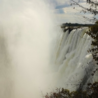
 They are not the highest in the world, nor the longest, but they are the largest in the world: the Victoria Falls. On the border between Zambia and Zimbabwe, the Zambezi river falls with thunderous force over a width of more than 1700 meter. The highest point is 128 meters. The falls are recognized as World Heritage by UNESCO and were named by CNN as one of the seven natural wonders of the world. Since the first tourists visited the falls in 1900 it has become one of the most visited highlights of Africa. A place that we obviously cannot pass without stopping.
From the campsite at South Luangwa National Park it takes a few days to get to the waterfalls. Long days with lot of asphalt-kilometres on one of the main roads of Zambia. To avoid that we have three very boring asphalt days, we decide to take a short cut over some back roads along the national park on the first day. 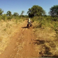 A trip of 180 kilometres over dusty dirt roads. And because off-road kilometres often take just a bit longer than asphalt kilometres the alarm goes off early that morning.
We say goodbye to our neighbours and drive back to the exit of the campsite. The main road is no more than a dirt road with deep tracks. We do not only see tracks of safari trucks and bicycles, but also of lizards, antelopes, elephants and other animals. One set of tracks looks suspiciously like that of our cat Sammy, only a whole lot bigger! In my head I hear how the manager of the campsite told us about hungry lions and angry elephants. I tell myself that on the bikes we do not look like a moving lunchbar and ignore the feeling in my stomach.
We drive through a forest, pass vast open plains and cross dry riverbeds. Apart from a few men on bicycles we encounter in the first ten minutes, we see no other traffic. After an hour we have to stop in front of a barrier that is lowered over the road. 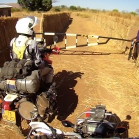 It seems to be a police checkpoint. We tell the man at the gate where we are going and explain that the GPS shows us the route so we cannot get lost. He seems satisfied with our answers. He takes one more look at the motorbikes, opens the barrier and wishes us a good journey.
Today it is my turn to ride in front with the GPS. Although I do not ride fast, Peter is far behind me. He slowly makes his way over the dusty path while he looks around him, searching for animals. If he sees animals, it is no use to call over the intercom; “Look there, a deer.” I will not know where to look and will have passed the animal before I have a chance to see it. With military precision he therefore says: “Impala at 11 o’clock” or “Elephant on your 3 o’clock.” It works perfectly.
The road is littered with huge piles of elephant dung, some still very fresh. Given the amount of dung, there have to be a lot of elephants around here. But they hide well, because of all the hidden elephants we eventually only see a few. At first we see some in the distance, but later they are quite close to the road. With the bikes still running, we look at them from a distance and see how they slowly pull some branches from a tree. 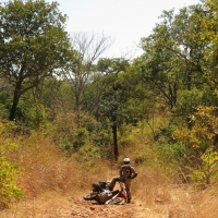 After that we see a lot of impalas. Startled by the noise of the bikes, they gracefully run with high jumps into the bushes. Some are so confused that they jump right in front of the bike and run with us for a while or even run towards us. We have to watch their moves.
It is clear that this route is not so often used, especially not by car. The road becomes narrower as we continue, not in the last place because the bushes overgrow the road. At some point we drive on a single track down through sandy riverbeds and up again on steep slopes with loose stones. All in all not a very challenging route, but you do need to keep an eye on the road. Loose rocks and searching for animals is perhaps not the best combination. And so it happens that I hear a yell over the intercom and then: “My bike is on the ground” As I walk back to help Peter lift his bike up I see him standing on his motorbikes as a hunter that has just shot a lion. The bike is still fine, as is Peter, he only has a small dent in his ego.
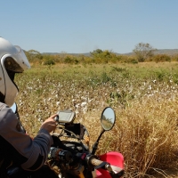 It is sunny and there is hardly any wind. On hot days like this, we both empty our Camelbak of 1,5 liters two or three times. And as it happens, the water that goes in has to get out again some way or another. I have been wanting to pee for at least the last 50 kilometres, but I do not want to lower my trousers in this dense forest near the hidden elephants and possibly even lions. Only when I feel the park is far away, my full bladder wins from the butterflies in my stomach. What a relief!
At the end of the afternoon we see some cyclists again. Not long after that we pass through several small villages. In one of the last villages a truck is being loaded with bags full of fluffy cotton balls. The work is briefly halted as we pass. We hold up our hand to say hello and get a friendly smile back. After we have passed the truck the road is a lot better and it does not take long before we are back on the tarmac in Petauke. Tired, hungry and cakes with dust we find a campsite and a hot shower at a conference center.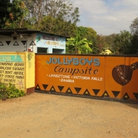
From Petauke it it still a two days drive to Livingstone, the village in Zambia from where we can visit the falls. Two boring days with little to see along the way. While driving we listen to music over the intercom to kill time. I sing along with all the songs. In my helmet it sounds just a good as in the shower!
We only let go off the throttle to eat or to refuel. The first day we drive 400km to a campsite just outside Lusaka. It is the 100th place we stay at during our trip, a small milestone. The next day we drive from Lusaka to Livingstone in one go. With 500 km it is the longest day trip during our travels. A record we do not want to break any time soon, because at an average speed of 80km/hour it was a very long day. With a sore bum and stiff shoulders, we find a camping spot at 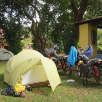 Jolly Boys Backpackers at the end of the day. We take out a large pizza, drink a well deserved cold beer and watch how the Dutch soccer team only just beats Mexico in the last minutes.
The next day we meet with our French neighbours, Nathalie and Jean-Marie, who travel around the world with their children Zoé and Yan on three bicycles (Blog). While the children do their homework, we are over the map of Africa to exchange routes. It is great talking to them and very inspiring to hear their stories.
That day we visit the falls which are just outside Livingstone. They can be seen from far away, as there is a large white cloud with a colourful rainbow in it above the river. Livingstone was the first European to see the cloud and the waterfalls in 1855. Overwhelmed by their beauty he named the falls after Queen Victoria.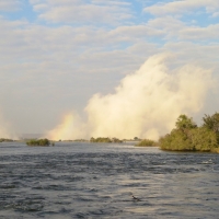 The name that was given by the locals were long before that was “Mosi-oa-Tuny“, which means “the smoke that thunders”. And indeed, the closer we get to the cloud, the louder the thunder is that arises from the depths.
From the entrance of the Victoria Falls National Park, we take a walk to the ‘Boiling Pot’. At the bottom of the falls the water pushes through a narrow gorge creating a huge whirlpool in the first bend of the gorge. From the Boiling Pot we have a nice view on the railroad bridge that crosses the gorge. The bridge was built in 1905 as part of a railway line from Cape Town to Cairo. The track was never completed, but the bridge is still in use as the border between Zambia and Zimbabwe. And not only that, from the bridge you can bungee jump into the deep gorge. While we at sitting at the waterside, one brave tourist after the other jumps down with a loud cry.
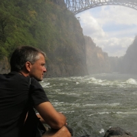 Then we take a look at the falls from a little closer. With a raincoat on and our cameras in a plastic bag, we begin to walk to the viewpoints on the other side of the falls. While it is a very sunny day, we are standing in the rain within a few meters. And that rain does not only fall from the sky, because it is raining up!! A thick spray rises from the falls to then drop down again. When we walk across a small bridge to the viewpoints we are soaked within a few seconds. The falling water creates a roaring noise and we have to shout to be able to understand each other. There is no chance to take a lot of pictures, because it is raining too hard. Moreover, we can hardly see the falls through the spray. But even in the rain and without any good views it still is great to be here. How great the force of nature can be, awesome!
Once we are back in the sun, it does not take long before our clothes are dry.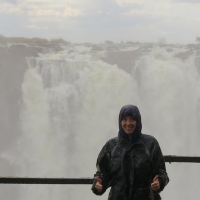 Now only Peter’s shoes are still soaked. On the edge of the gorge can you easily see how sunny it is above the river and how hard it is raining across the falls. We can hardly see the bridge over which we just walked. Just like the large groups of Japanese who visit the falls, we make at least another hundred pictures before we return to the campsite at the end of the afternoon. I am glad we stopped to come here!!
Distance travelled to Livingstone: 21.599km (13.421 miles)
Click here to view the photos.
Previous story “Secret of Africa” – Next story “The wild South“


In één woord: GEWELDIG!
500 kilometer hobbelen over zandpaden en hobbelwegen.. sjonge.. jullie moeten een Tefal-ass hebben onderhand..
Wat weer een mooi verslag. Ik hoop dat Peter zijn ego inmiddels weer uitgedeukt is. 😉 Ik heb in iedergeval veel respect voor jullie. Heel veel liefs, Jan en Anna
Humoristisch geschreven en prachtige fotoos. Maar we vragen ons af waar jullie nu, 15 okt. zijn. De verslaggeving loopt flink achter. Gr. Anja