


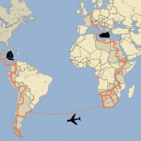
 After a great time in Stellenbosch and a nice week in Cape Town, it is time to move on. Time to pack our bags and take the bikes out of storage after four weeks. With new tires, new chains and fresh oil they are ready to get going. And with clean suits, well-rested muscles and butterflies in our stomachs, we also want to hit the road again. The coming weeks we make one last round trip in Africa before we take the bikes to South America. From Cape Town we will follow the Cape-Namibia route to the north to travel through Namibia and Botswana.
And we will not go there alone, but with my father. Dick does not ride motorbikes himself and he cannot get on the back of our bikes. To be able to travel with us through Africa, he has rented a Toyota Land Cruiser. A strong 4×4 that he can take to all the gravel and dirt roads along the way. The car has a roof tent and an extensive camping equipment so that he can go camping with us. After all our stories it is the perfect car to experience first hand what it is like to travel through Africa like we do.
 We have agreed to meet the man of the rental company at the airport of Cape Town to pick up the car. And this is no case of handing over the keys and go! In the parking we walk around the car more than an hour while the man explains about the 4×4 system, the air compressor, the sand boards, the jack and other adventurous attributes that Dick might need. Then we check the entire camping equipment and we even get a demonstration of the rooftop tent. Once all forms are signed, the keys are handed over and we set off. The first kilometres in the huge colossus of a car on the ‘wrong side’ of the road are a little uncomfortable, but by the time we arrive in Stellenbosch at African Overlanders the ride is very smooth.
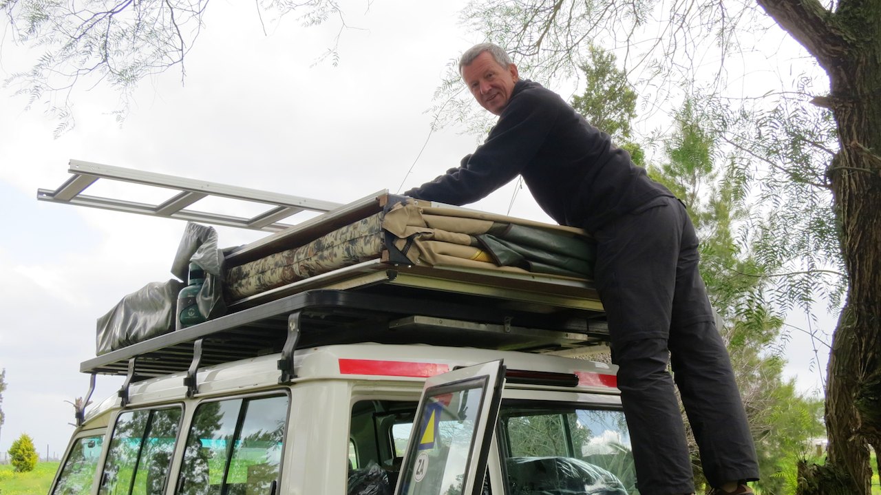 We drink some coffee with Duncan and go our own way to prepare for the trip. Peter works some more on the bikes, I pack our bags and Dick takes out his rooftop tent. That evening we end our visit to Stellenbosch with Dick, Duncan and Elli at a braai organized by neighbour Jo. While the meat is outside on the grill, we sit inside around the fireplace with a glass of wine. It is particularly bad weather, the rain is pouring from the sky. This is no weather for a barbecue and actually no weather for camping either. Our tent stays in our bag, because tonight we sleep in Jo’s guest room. Dick does crawl into his rooftop tent that night, despite the storm. Brave, because it is not really a good night to start a camping holiday.
The storm continues during the night and wakes us up several times. The wind blows through the cracks of the house and outside a small waterfall has formed next to the door. We silently wonder how things are going in the rooftop tent. The next morning we find Dick in the communal kitchen of the campsite, in his raincoat and wearing his hat. He had been busy folding his tent, but stopped to find some shelter from the rain.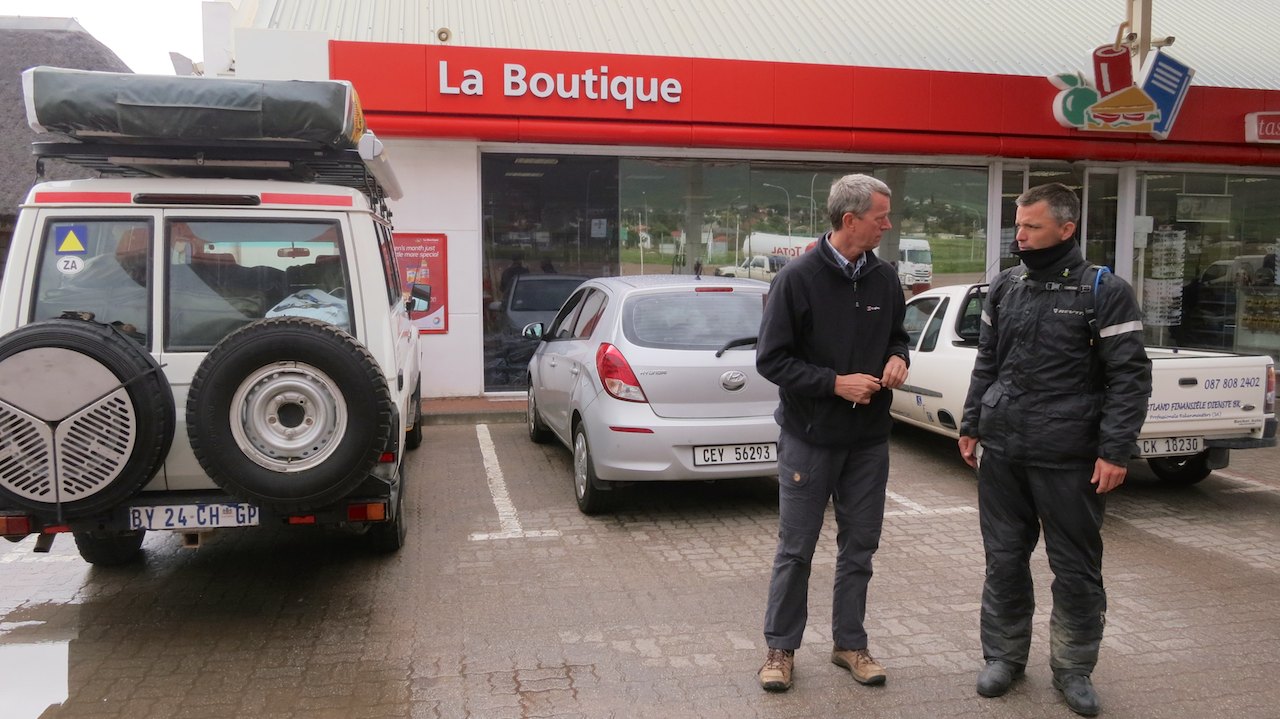 He had barely slept that night because his tent was nearly blown of the roof. To make matters worse, the mattress had been wet from the rain. About time to leave and look for the sun!
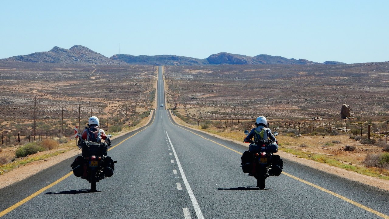
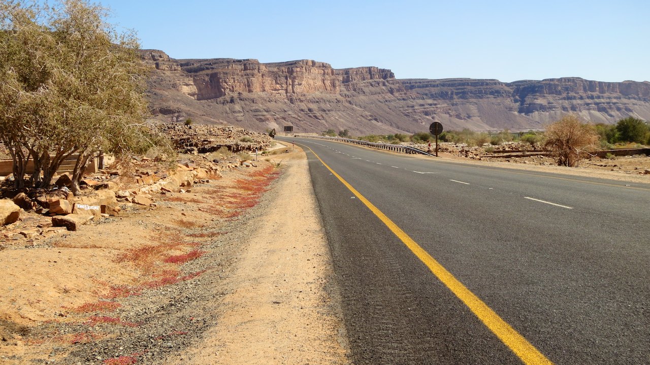
At the end of the morning we leave African Overlanders. We are wearing our rain suits and have switched on the heated grips. Dick has turned on the heater and has set the windscreen wipers to the maximum speed. We turn onto the highway to Cape Town and from there follow the N7 north. This highway is known as the Cape-Namibia Route, a route that is used by South African holidaymakers that go to Namibia. You could say it is the South African counterpart to the Route du Soleil that we follow in Europe toward the French sun. We hit the gas and only stop to refuel and to warm ourselves at the fuel station with coffee and a sandwich.
 The first day we camp in Van Rhynsdorp at the caravan park. It is one of those typical campsites you can find near the main highways, also along the Route du Soleil. A simple camping area that is empty during the day, but full during the night with cars and caravans that are parked in such a way that they can quickly leave the next morning. Not a very inspiring place, but good enough for one night.
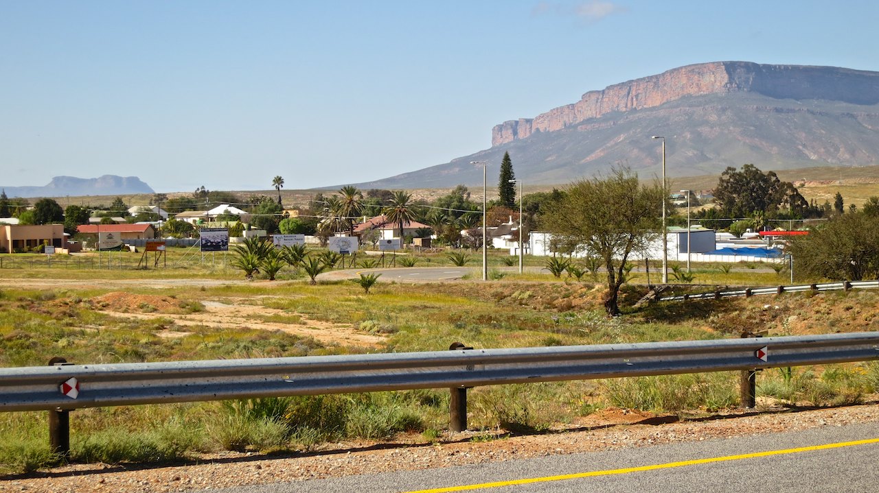
After a particularly cold night with freezing temperatures, we are three of the last campers to leave the campsite the next morning. Most caravans have already left. We need a little more time to pack our tent and put all our stuff back on the bikes. Furthermore, we always take our time for breakfast because we cannot eat our sandwiches while driving. The weather is a lot better than yesterday and the rain suits can stay in the bags. I do wear my woolen sweater, because the wind is still quite chilly. Not only the weather has changed, the landscape also begins to change. The vast meadows and fields are now followed by high cliffs and deep gorges. As in other parts of South Africa it reminds us of the landscape in western movies.
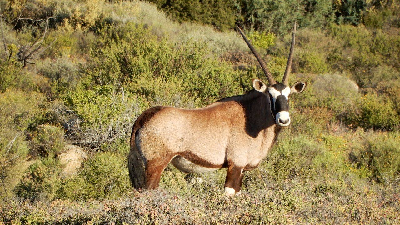
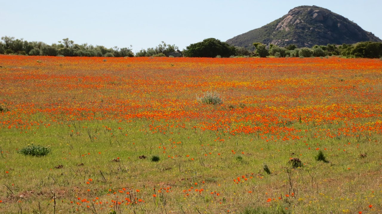 We cover a lot of distance and follow the Cape-Namibia route through Namaqualand, a region in the north-west of South Africa that is best known for a particular natural phenomenon that takes place annually. For a few weeks in early spring the arid country changes into a colored patchwork blanket when hundreds of thousands of flowers are in bloom at the same time. It is still early in the season, but the first flowers are already in bloom. We drive a scenic route through the Goegap Nature Reserve, past fields of red, orange, yellow and purple. Very beautiful, especially against the blue sky. And we do not only see beautiful flowers, but also the first ‘wild animals’: ostriches and oryx!
 We find a camping spot at the caravan park in Springbok, another one of those highway campsites that is full of holidaymakers heading to Namibia. We have a nice chat in Afrikaans-Dutch with our friendly neighbours, enjoy a hot shower and crawl into our tent early. This time not because of rain or freezing temperatures, but because of the very strong winds. The wind pushes our tent, makes the sticks crack and ensures that we hardly sleep that night. The next morning, all the gear is covered with a layer of sand. Our towels are at the neighbours, the tablecloth flutters against the fence around the campsite and during breakfast the muesli flies in the air. Once we are on the bikes it is not any better. Due to the strong side winds we lean into the wind and holds the motorbikes almost at an angle of 45 degrees on the highway. We struggle to stay on our side of the road due to the gusts of wind and are happy when the wind finally lies down at the end of the morning. We have had our portion of storm, rain, freezing cold and wind, it is time for the Namibian sun!
 Closer to the border with Namibia there are even less towns and buildings than before and the views are becoming grander. The GPS shows that we slowly descending and for us that is especially evident by the temperature that gradually rises. The road disappears in a straight line at the horizon, where the air above the asphalt trembles from the heat. Halfway through the day we drive into the gorge of the Oranjerivier, the river that forms the border between South Africa and Namibia. For us it is the fifteenth African border crossing where we have to get stamps in our documents. We still have to find out where we need to go this time, but we do know what to expect. Great, because that way we can help Dick with the paperwork for his first African border. All in all it takes a good hour, but by then we have left South Africa and are allowed to enter Namibia with the bikes and the rental car. Nice!
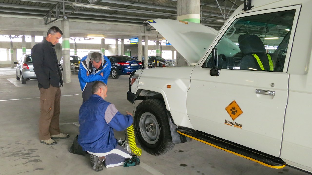
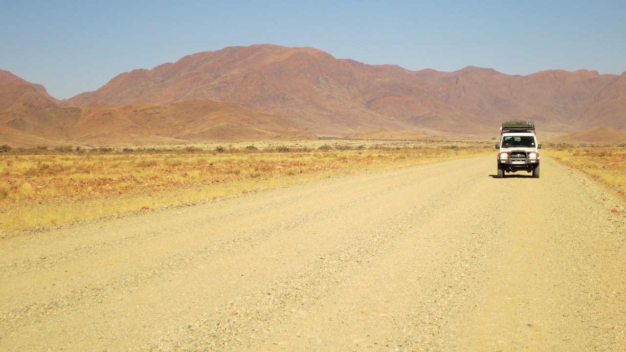
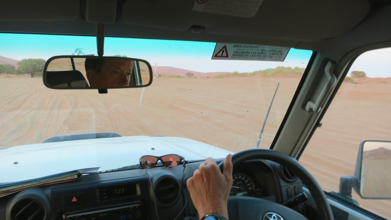
The first kilometres in Namibia we still follow the highway. It is a busy dual carriageway with a lot of big trucks. Not a nice road to drive and we are glad we can get off the highway a bit later to continue on the secondary roads. In Namibia, this also means that you leave the asphalt and get onto gravel. Only the three highways of Namibia and the main streets of the cities are paved. 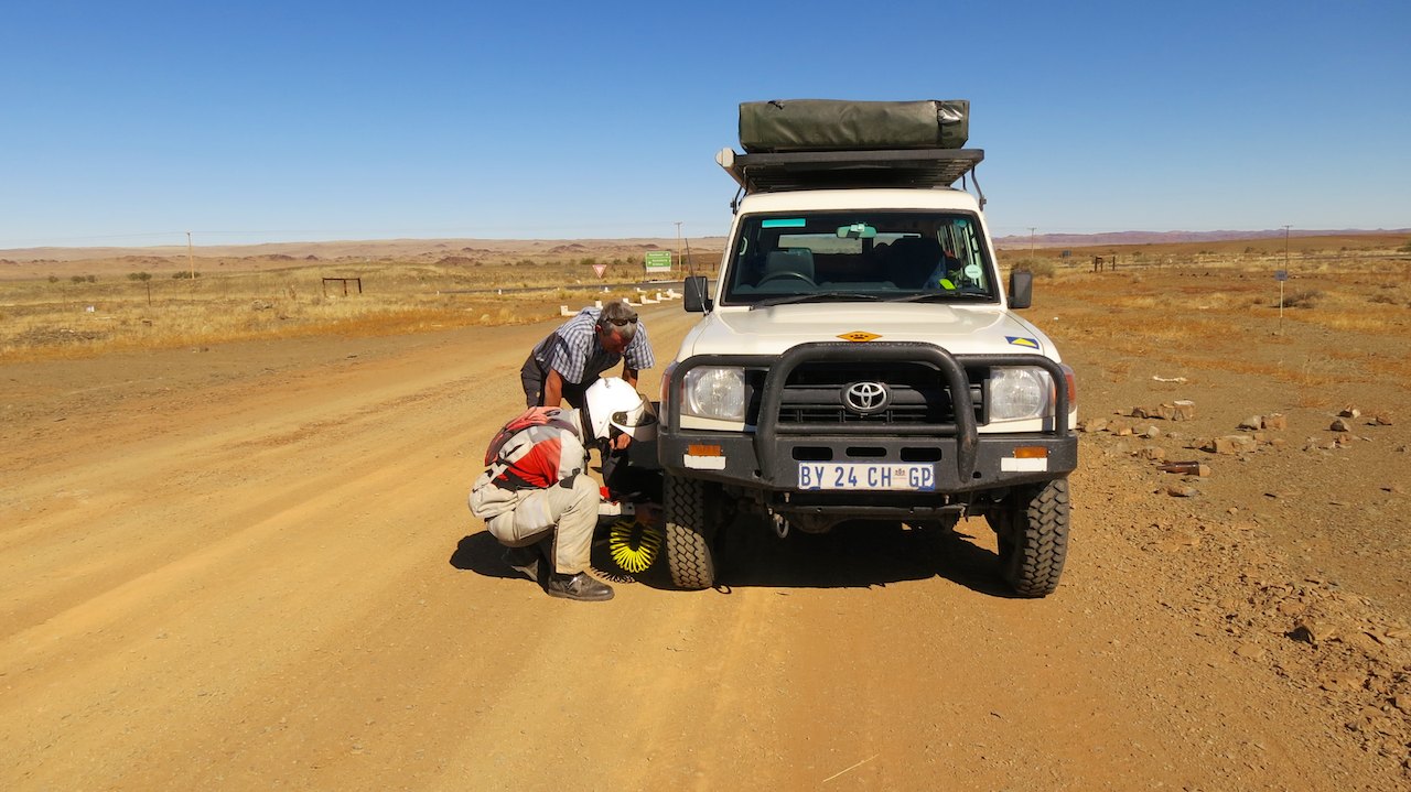 All other roads are dusty sand and gravel roads. Before we drive towards Ai-Aïs we first ensure that the tires of the car and the motorbikes are at the correct pressure to maintain sufficient grip on the gravel.
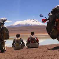
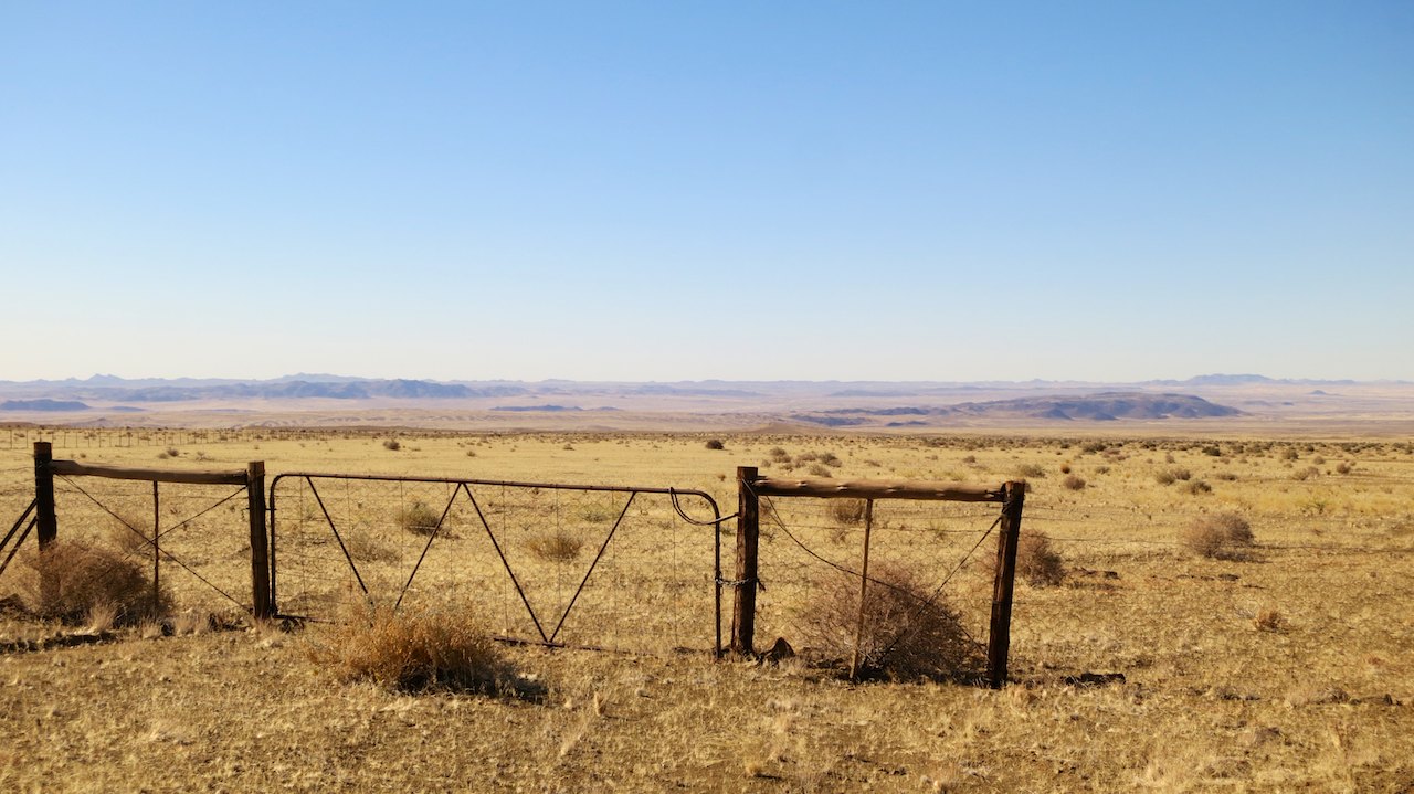
While Peter and Dick are crouched together beside the Land Cruiser to adjust the tire pressure, I stare at the stunning view. I look out over a large open plain, a dry field with low bushes and some hills in the distance. The hills are shrouded in a light haze of dust. The land is fenced. As far as I can see a fence runs parallel to the road. This has to be a rich landowner because I cannot even see the end of the fence. A farm or livestock is nowhere to be seen.
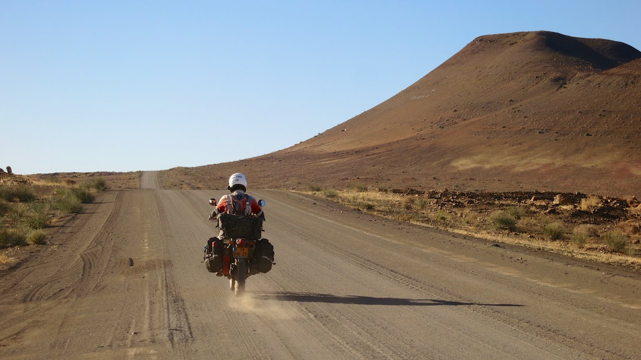
 Once the tires are at the right pressure, we continue in the direction of Ai-Aïs. A place in the hills with hot springs where we will spend the night at the campsite. The wide gravel road is in good condition and gives the opportunity to look around while driving. Only on the corrugated parts of the road we have to find the right speed and then that is also good for us to ride. This is a bit different for Dick. The Land Cruiser vibrates and shakes and makes a lot of noise. Quite different from the silent family car that he drives in the Netherlands. But just like driving on the ‘wrong side’ of the road, this is also a matter of experience and he soon finds out that the car can stand a beating.
 After we have been driving along the vast open plain all day, we drive in a narrow gorge at the end of the afternoon. The sun is already low in the sky and bathes the valley in beautiful floodlight. We follow the road to the deepest point of the gorge to the river where we arrive at a beautiful campsite. In front of the reception is a long line of well equipped 4×4’s, the campsite is full of tents and trailers and from the bar we hear the commentator of a rugby match. After the deserted roads of this afternoon where we hardly saw other cars, it is suddenly quit busy here. We take a cool beer to recover from this ‘shock’ and take our time to look around. What a wonderful place to camp here, in the middle of the gorge! And there is more: it is dry, sunny, warm and windless. This was what we were looking for, great!
The next day we drive from Ai-Aïs back to the main road. 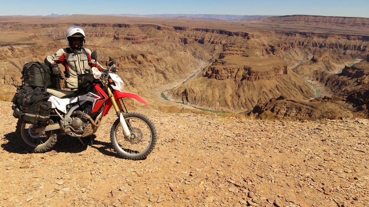 We continue our route to the north through the beautiful vast landscape. We ride along hills full of stones and steep rocks. At the end of the morning we see a gorge in the distance. That is our next destination; Fish River Canyon. After the Grand Canyon in the United States Fish River Canyon is the longest canyon in the world with 160 km. We drive to the lookout point and have a stunning view from the higher plateau over the deep gorge and the narrow blue stream in the depth. The stream has left a twisting scar in the landscape. Impressive to see.
From the canyon we continue on the dusty Namibian gravel roads. It is only our second day in Namibia, but everything is already covered in a thick layer of dust: the bikes, the bags, our suits, everything is a few shades lighter. My hair stands straight up and my face looks like a sand sculpture because of all the dust that is around my nose. The Land Cruiser is covered with a thick layer of dust as well. And despite the fact that all the doors and windows of the car are usually closed (for the air conditioning) even the inside of the car is dusty. If we try to wipe the dust off our gear, it swirls in the air like flower to come down again on the exact same place. We know from experience that it makes no sense to clean it, because tomorrow it is all dirty again. We should best ignore it. This time, it just takes a little longer before we get back on the asfalt again.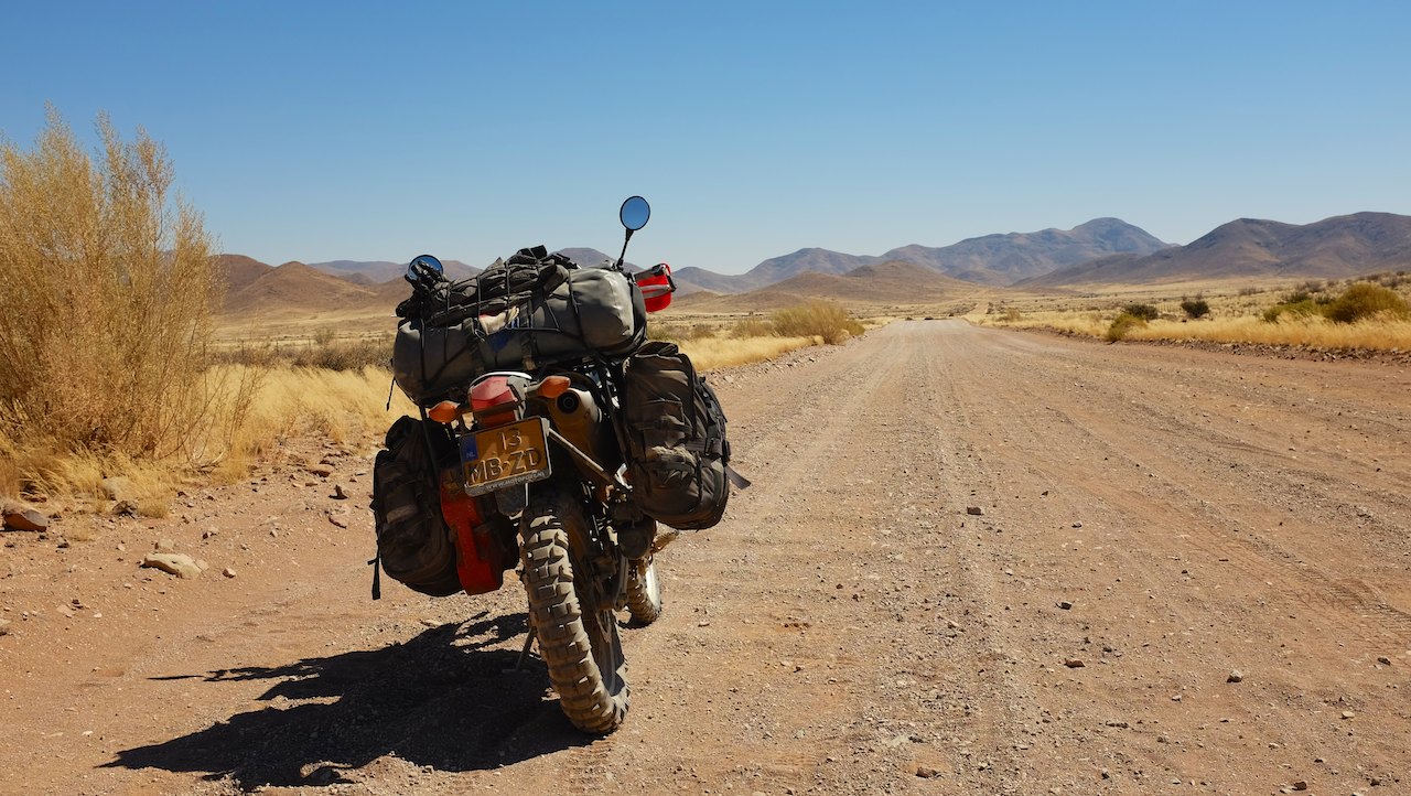
The distances between the villages are very long, sometimes a few hundred kilometres. Though you may not speak of villages. It are rather settlements, with only a handful of houses and a church. After Mongolia, Namibia is the least densely populated country in the world! In an area of 824.268 km², which is nearly 20 times bigger than the Netherlands, live only just over two million people. The population density in Namibia is 2.6 person per square kilometre, compared to a 406 person per square kilometre in the Netherlands. No wonder we sometimes feel like we are the only ones on this planet when we look out over one of those vast plains and see no other living being.
In these surroundings it is even more strange to find a wonderful restaurant in the middle of nowhere. When we stop at the Cañon Roadhouse for a late lunch, we feel like we are suddenly back in civilization. 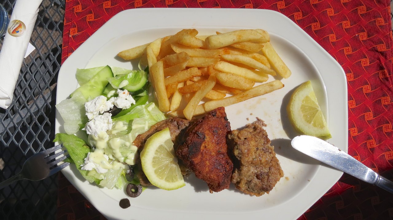 No dust, but a beautifully landscaped garden with a terrace and a neatly set table. It is almost un-African. The ‘roadhouse’ is an attraction in itself, because both inside and outside old cars, motorcycles, advertising signs and road signs are used for the decoration. A real museum. And the biggest surprise is the menu, because they not only have “Apfelstrudel” but also Schnitzel! Namibia was a German colony for a long time and you do not only see that in the names of the towns, but also in their menu. We order three African versions of the schnitzel, made with meat from kudu and springbok and fully enjoy this pleasant surprise!
After the pit-stop we get back on the bikes for the last part of that day. The surroundings are beautiful and the panoramic vies are amazing. Especially the views of the plains are very impressive. The hills we pass have beautiful shapes, lines and layers. And the colours in the landscape all seem to fit very well together, with different shades of green, brown and yellow. We often stop to take pictures, but also to refill our drinking bags with water. It is hot. 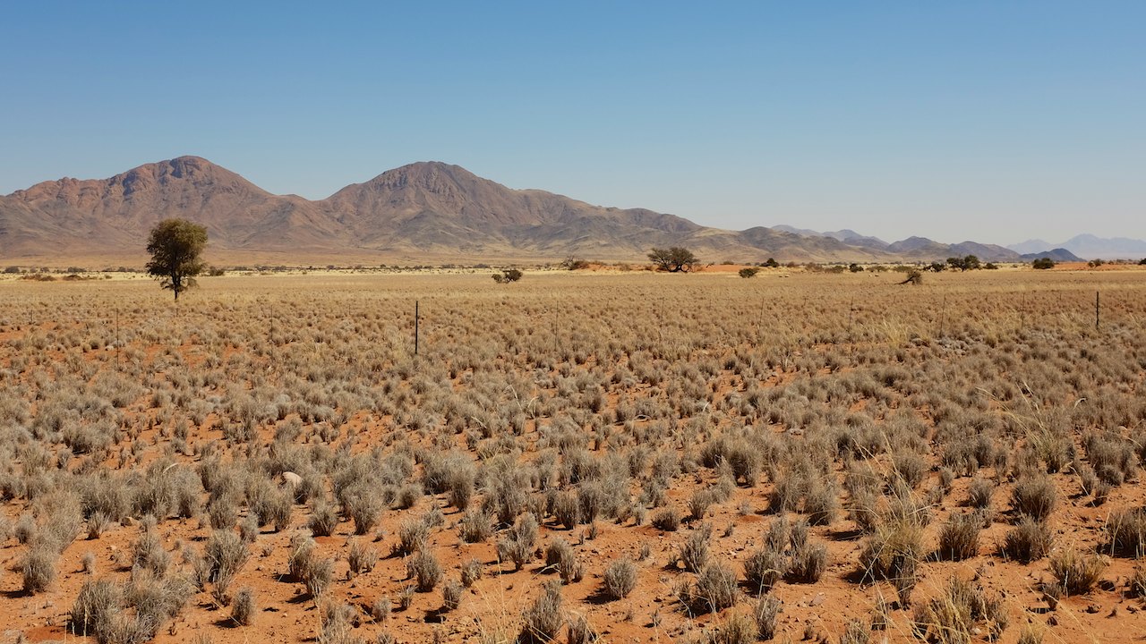 The air is dry and sometimes feel like a hot hair dryer, just like in Sudan. We are in fact riding through a desert, even though is looks very different than the vast sands of North Africa. The desert here has low bushes and some trees. We even see some groups of oryx and springbok and one or two zebras!
We meet hardly any cars on the road. The few cars that we cross, we see from afar by the cloud of dust that is behind them. Often they are also tourists who, like Dick, have rented a nice car with a tent on the roof and a sticker of the rental company on the bonnet. When we stop to take a picture it happens several times that other cars stop next to us to ask us if everything is OK. Everyone seems to take a bit more care of each other here. A flat tire or an empty tank could be quite annoying in these desolate regions.
 The distances between the villages are great, which means that the distances between fuel stations are great as well. With the map in our hand, we plan our route along some fuel stations where we can fill up our tanks. It brings us to special places, such as Guagep. It is a settlement of no more than 7 houses, which are built around a train station. The train does not seem to be in use and looks deserted. The fuel station is no longer in use either. The pump has been removed, there is no glass in the windows and the roof has partly collapsed. A tumbleweed rolls over the concrete, further adding to the feeling that we have arrived in a ghost town. And yet, even here in this desolate corner, live people. From the houses we are stared at by prying eyes that dodge when we answer their gaze. What a place to live!
In Bethanie we have more luck. It is a village with a hundred houses, most with a nicely landscaped garden, built on wide paved avenues. In the middle of the village is a huge church, with opposite of it a fuel station. It is Sunday and the small village is deserted, but luckily for us the fuel station is open. With full tanks we drive towards Helmeringhausen. According to our map, the village should not only have a fuel station, but also a campsite where we can stay the night.
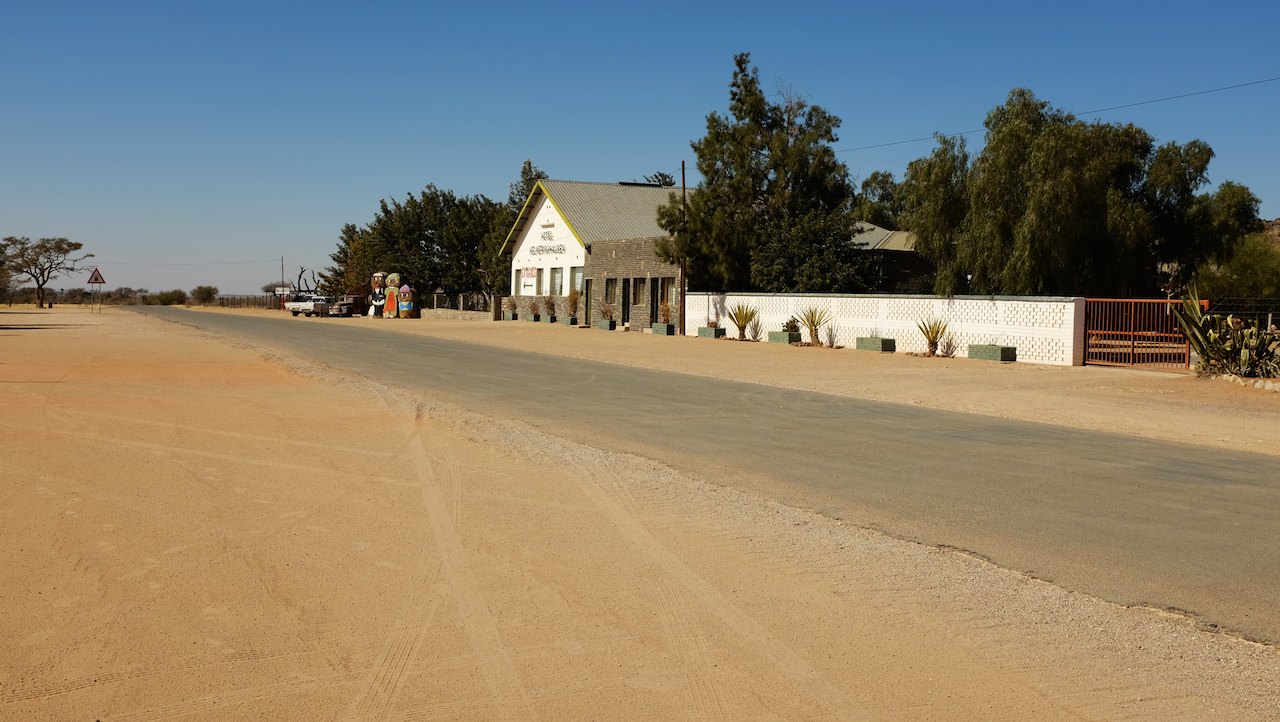 The road from Bethanie is in very poor condition, with long stretches of “washboard road”. We have to make quite some speed to not have too many problems with the bumps, but at the same time pay attention to the deeper parts of gravel in the curves and the many animals that unexpectedly cross the road. It is late and the low sun makes driving even more tiring. The three of us are glad when we safely arrive in Helmeringhausen at sunset. It is a small village, with a handful of houses that are all built on the only street of the village. And in that little village they yet again have everything we need: a fuel station, a grocery store to refill our supply of food and water and a beautiful campsite. After a long tiring day it is really great to rinse all the Namibian dust of in the shower.
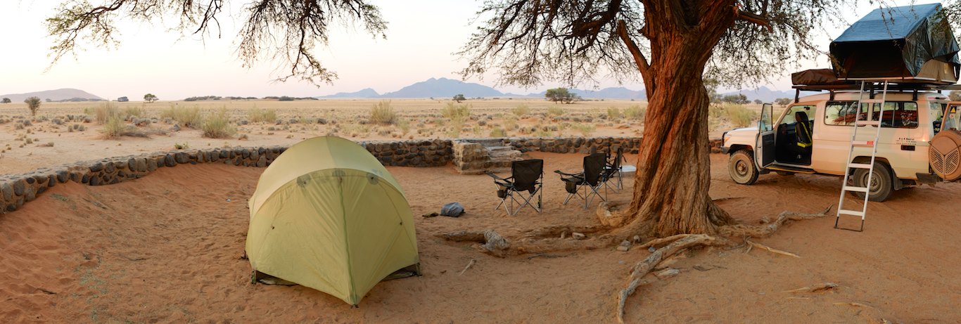 After a hearty breakfast we leave in the direction of the Namib-Naukluft National Park the next morning. From Sesriem we will visit the beautiful sand dunes of the Sossusvlei and the petrified trees in the Deadvlei. It is a long day with a lot of mileage, but we take it easy. Especially because we often stop to take pictures. The landscape is truly beautiful! At the end of the day we reach the gate of the national park. We made a reservation for two nights on the campsite in the park and are pointed to a beautiful spot overlooking the open plain. With a cold beer in our hand, we see how the sun sinks below the horizon and how the sky turns red, orange and pink. Wow!
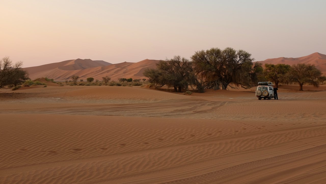 The next morning the alarm goes off at 04:00 AM. This is not a day to sleep in late, because we want to see the sunrise at the Sossusvlei. The main gate only opens after sunrise, but because we stayed the night inside the park boundaries, we can drive toward the sand dunes well before that. Peter and I are not allowed to go to the dunes on our motorbikes, so today we join Dick in the Land Cruiser. In the dark we together fold his rooftop tent to leave as early as possible. We join in a line of cars, all campers on their way to the sand dunes. It is 60 kilometres from the campsite and it is slowly beginning to become light. In the distance we see the first sand dune.
At the end of the asphalt road there is a large sign indicating that the last five kilometres are only accessible to 4×4 vehicles. The cue for Peter and Dick to deflate the tires to the correct pressure for the deep sand and turn on the 4×4. 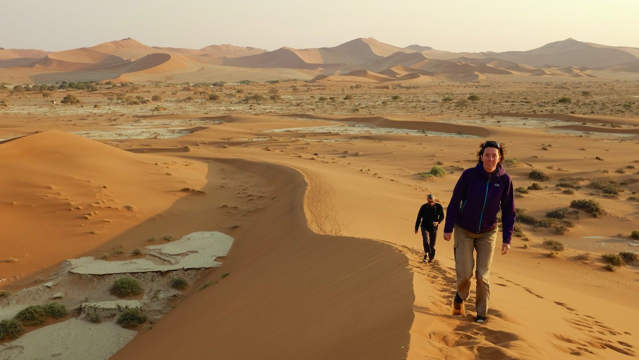 The first rays of the sun are coming over the dunes, shrouding the valley in beautiful light. After a (too short) fun ride through the deep sand we park the car at the foot of one of the high sand dunes. The salt pan on which we stand has dried up to a beautiful structure. We walk across the parched salt pan and begin the climb up. From the top of the dune, we have a great view of the Sossusvlei. The rising sun illuminates the dunes on one side, which accentuates the sharp ridges with the graceful shapes. We sit down into the sand and see how the sun slowly climbs higher. It is breathtakingly beautiful.
From the high dune we can also see the Deadvlei. The valley with the petrified trees is hidden in between the high dunes. 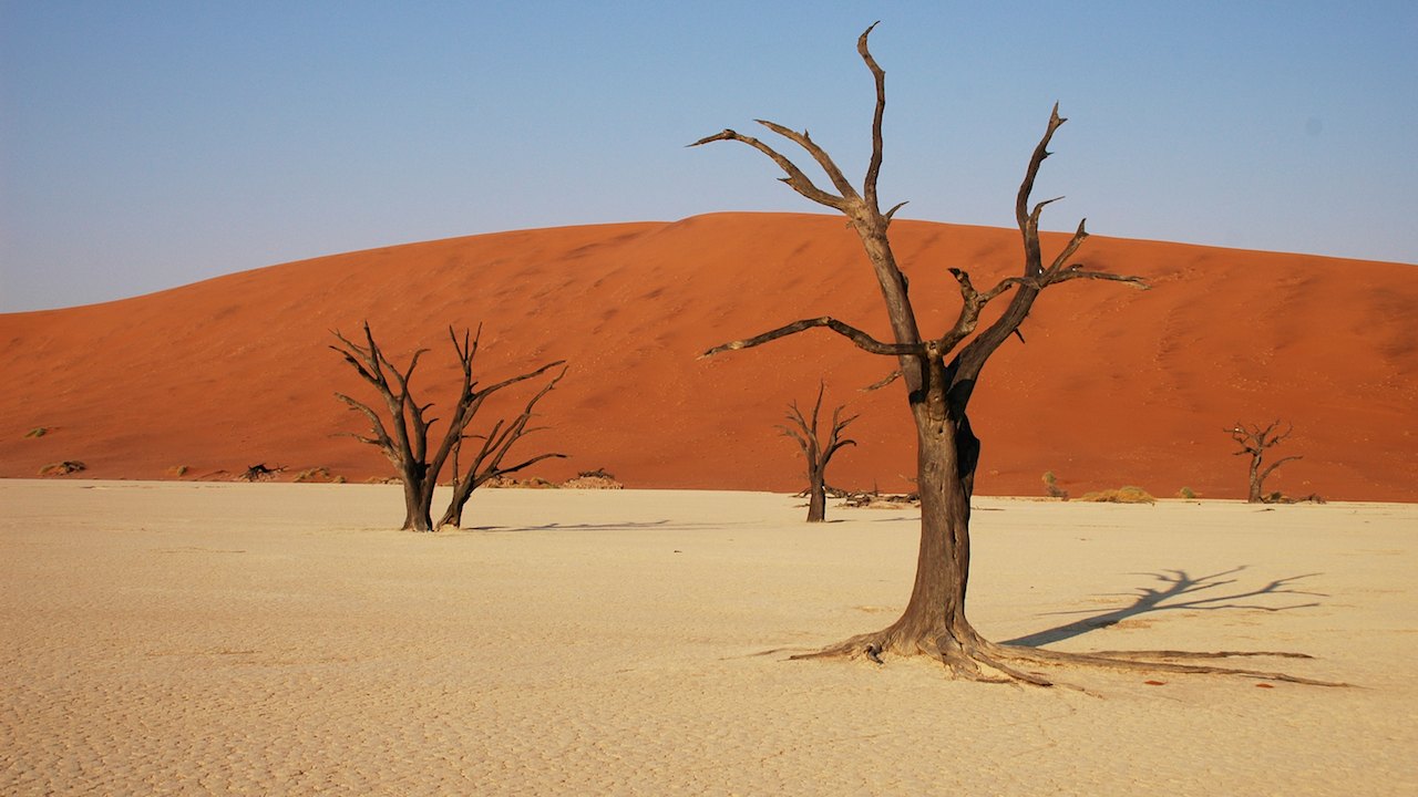 We walk down along the steep side of the dune toward the Deadvlei and sink deep into the sand. Once down you can really see how big the clay pan with the trees is. The trees have died due to the drought, but have been preserved. It is estimated that some specimens are over 900 years old. The trees have been scorched by the burning sun and look beautiful against the white clay, red sand dunes and blue sky. It results in a lot of pictures!
After the three of us have taken so many pictures that we can fill a large album of only the Sossusvlei and the Deadvlei, we slowly walk back to the car. It is time for breakfast. We take out the tablecloth, cover one of the picnic tables in the parking lot and see the first buses with tourists arrive in the distance. The park gates are open. We are happy that we were here very early to have the place to ourselves and enjoy the sand dunes and the Deadvlei in peace.
 After breakfast a nice ’desert’ awaits us: the ride through the deep sand back to the asphalt. With some good music from the speakers and big smile on Dicks face we swirls around the rough terrain through the deep sand. Cool! In the parking area we inflate the tires again to the right pressure for the last stretch to the campsite, where we spend the rest of the day in a chair enjoying the view.
Distance to Sesriem: 27 666 km (17.191 miles)
Click here to see the pictures.
Previous story “A guest from home” – Next story “Land of extremes“
Jeetje wat fijn om dat met je vader te kunnen delen. Xxx
Prachtige foto’s!
Kus, Mip
Wat een prachtige bloemenvelden! xxxx
Hoi Peter en Leonie en vader Dick,
Wat weer een prachtig verhaal je waant je met wat fantasie zo in afrika! En die kleuren zooooooooooo… mooi! Geweldig heb het al vaker gezegd, wat een avontuur!
Wens jullie drieen alvast een prettige Kerst en een voorspoedig Nieuwjaar en een goede reis!
Groetjes Heiko