


 After we have filled all tanks and jerrycans with fuel again, we find a place to sleep in Willowmore via the owner of the garage. He sends us to Jumpers Place, a hostel for bikers that is run by his daughter Lisa and her husband Rony. A good tip, because that night we only crawl into our bunk beds very late after a great evening with huge T-bone steaks, too many beers and lots of bike-talk. The next morning Rony makes us a ’men’s breakfast’ with eggs, bacon, beans and toast, before he shows us the best way to drive from Willowmore to the coast.
From Willowmore, we first follow the main road to Uniondale. It is chilly and it slowly starts to rain. On the horizon the sky is even darker, so we stop to get our rain suits out of our bags again. And that is a good decision, because ten minutes later it is pouring with rain. In Uniondale we leave the main road and ride to the town of Avontuur, where we want to get onto a gravel road towards Knysna. The gravel road is closed to traffic because a few kilometers down the road a truck is blocking the way. We convince the men at the roadblock that we will probably be able to pass with our bikes and are allowed to continue anyway. Great, because this is much more fun than following the highway to the coast.
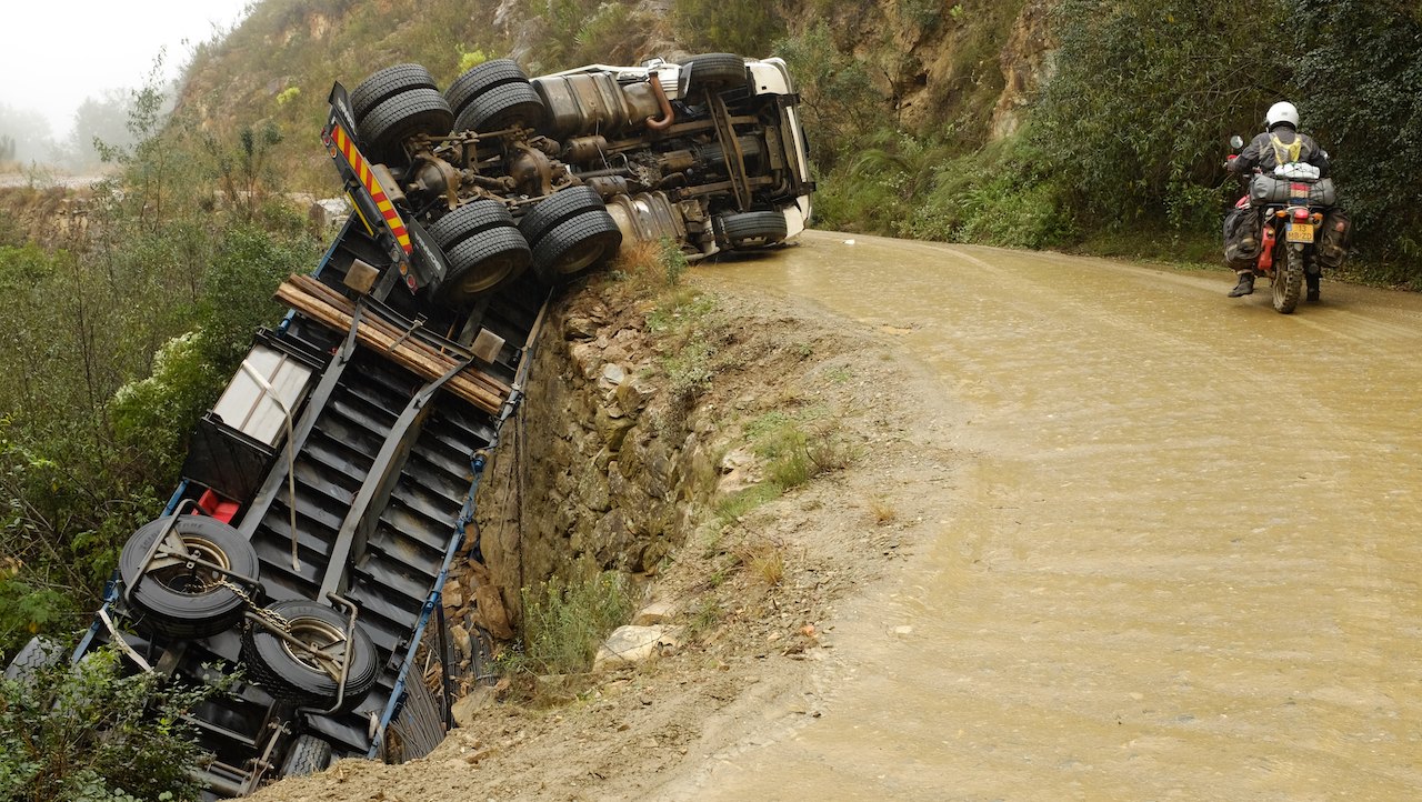 We drive on the narrow road into the hills, higher and higher, until we drive into the low clouds. Because of the dense fog we can only see a few meters far. It is like driving through a tunnel with the black-brown mountain on the right and a white layer of cotton wool on the left. After a few kilometers we pass the overturned truck. The road is so narrow that we do not understand how the truck got here in the first place, let alone how it can ever be towed away. It is no problem to pass it with the bikes, so we can continue to follow this road to the coast.
It has rained a lot and the road is quite slippery at some parts. Especially in the curves we have to pay attention that we do not slide on our side just like the truck. Slow as a snail we continue to ride through the hills. The rain has now turned into drizzle and that is perhaps even worse, because the small drops are not blown from our vizor at this speed. We both leave our vizors open to be able to see the road. With a wet and cold face we drive through the narrow gorge of the Keurbooms river. At the beginning of the afternoon we see some blue sky at last. For the first time, we can also see the beautiful area we have been driving through. The colors in the valley are beautiful, with different shades of green and bright yellow, purple and orange flowers. Because the road is closed, there is no other traffic on the road so we can stop anywhere we like to take pictures.
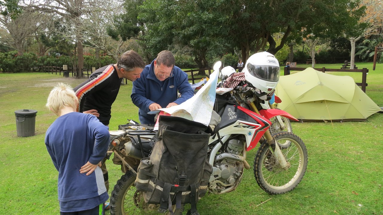 At the end of the afternoon we arrive in Knysna, a beautiful town on the Wild Coast with a large bay and big houses perched on the cliffs overlooking the ocean. The weather is not so good, so instead of visiting the town we spend the rest of the day in the tent with a movie on the laptop. We only go outside to cook. The next morning the weather is a lot better, we can even have breakfast in the sun. On the campsite we meet our South African neighbors Deon and Lara and their kids. Deon also rides motorbikes, which -as always- leads to a long talk about bikes, tires, oil and other bike-stuff. He gives us a tour through the camping-trailer he built and then takes out the map of South Africa to point out the best way to drive to Cape Town.
A nice meeting that we will not forget anytime soon because Deon made a lasting impression by introducing us to ‘biltong’. This typically South African snack consists of seasoned, dried meat and is usually made of beef or game. Like the ’braai’ (BBQ) and the ’bakkie’ (pick-up) biltong is a mandatory item in the lives of South Africans. This also becomes clear when Deon tells about the best places to go for biltong and the time he ate a kilo of biltong in half an hour because he could not take it on the plane. When he hears that we have never tasted biltong, he walks straight to his car to get us two vacuum-packed bags. It is dark brown, tough and -to be honest- looks a bit like dog food, but it tastes really great! 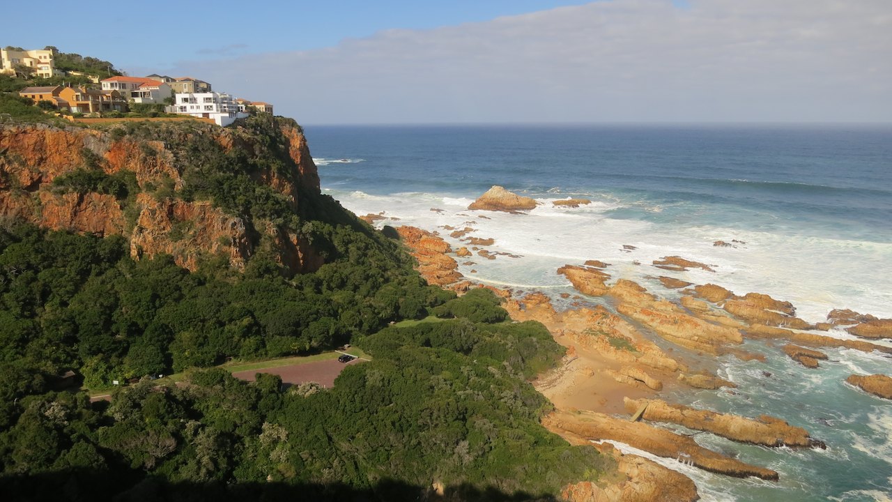 We eat all of it that same day!
Now the weather is better, we go for a tour around Knysna. The town is built on a bay that is connected to the sea by a narrow gorge between high cliffs. It is almost like a gateway has been carved into the cliffs. The cliffs next to the gorge are known as ‘The Heads’ and are notorious for the large number of ships that sank in the rough waters on their way to Knysna. On ‘The Heads’ are beautiful large villas with a priceless view over the ocean, the gorge and the bay. From Knysna we drive along the coast to Mosselbay, the town where Europeans settlers set foot on South African soil for the first time in 1488. Although I must admit that this was not the reason why we went to Mosselbay. That was mainly because we had read in our guidebook that, only second to Hawaii, Mosselbay has the mildest climate in the world! A great place to stay an extra night. We find a place to sleep at Mosselbay Backpackers and choose a bed in one of their dorms over the sleeping mats in our tent.
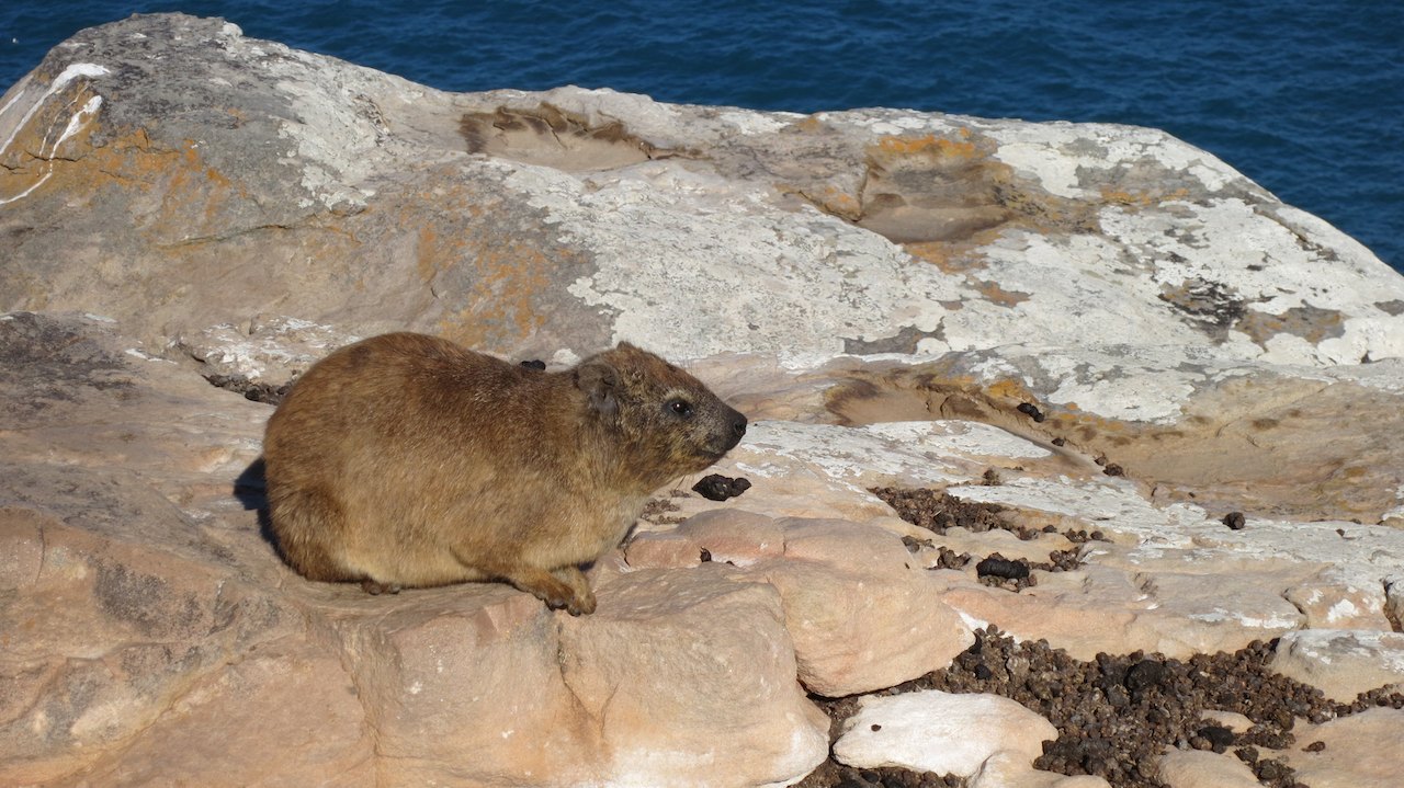 From the hostel we take a walk along the coast the next day. The sun is shining and there is a nice breeze. We are certainly not the only ones out enjoying the nice weather. Surfers are waiting for a good wave in the surf, fishermen stand on the rocks staring at their line and on the terraces tourists are enjoying a white wine. We follow a path along the cliffs. On the rocks are hyraxes, “dassies’ in Afrikaans. They warm up in the sun, but quickly run into the bushes as we walk along.
Just like in Port Shepstone we search for whales. Around this time of the year we should be able to see Southern right whales. On a plate in the harbor is mentioned how we can recognize this type of whales by the shape of their tail, the white callosities on their heads and the double steam puffs they make when they blow out. Today it is again easier to find them than we thought. From the top of the cliffs we do not even need the binoculars to see the V-shaped clouds of steam. Just outside the village, at the bottom of the cliffs are as many as four whales together in the water. For an hour we see how they dive under water and come up again, how they roll on their side and swim over each other. 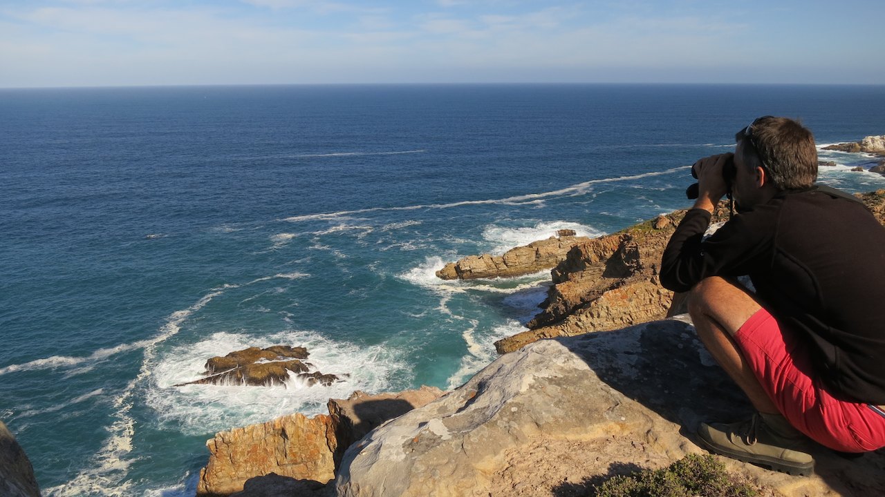 It is as if they are dancing or playing. With far too many photos of playing whales and a smile on our faces we return to the hostel at the end of the afternoon.
The day after that, we first follow the highway from Mosselbay until we reach the exit that Deon had recommended to us. From Heidelberg we drive on gravel roads in the direction of Cape Agulhas. It is a beautiful route along vast green fields with some fields with bright yellow flowering rapeseed. Mid-afternoon we pass through the village of Malgas where we need to cross the ‘Breederivier’. And that is not done by a bridge, but with a ferry that is moving on pure ‘manpower’. The ferry is taken to the other side by two strong men. They have a band around their chest with a chain that is attached to the rope that has been stretched across the river. Once they put their full weight in the band around their chest, the ferry slowly starts moving. They then attach the chain at a different point to the rope and pull the ferry a bit further. 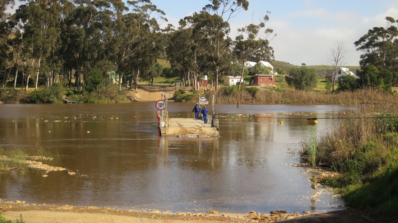 It sounds like slave labor and it also looks a bit like that, so I am quite glad we only have two light motorbikes to take across and not some heavy overland truck.
The crossing is not very fast, so we have plenty of time to take pictures, chat with the men and read the signs that are fixed to the ferry. Like the names of many towns and rivers, a lot of signs along the side of the road are in Afrikaans. Especially in the rural areas more Afrikaans than English is spoken. We can understand the signs on the ferry without any problem, especially if we pronounce the words as they are written. It is also easy to understand the spoken Afrikaans, to us it sounds a bit like an old-fashioned Dutch dialect. It often happens that we are addressed in Afrikaans once people hear that we speak Dutch to each other. If we speak Dutch slowly and they speak Afrikaans slowly, we can have a normal conversation.
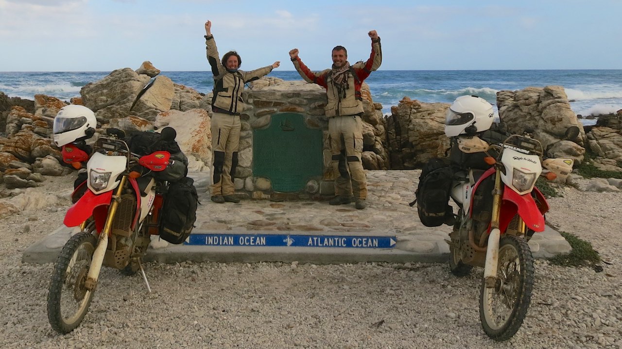
Once on the other side of the ‘Breederivier’ we drive from Malgas on the gravel roads to Bredasdorp where the asphalt starts again. We turn left and drive in a straight line to the south until we arrive in Struisbaai at the Indian Ocean. It is cloudy and it looks like a storm is coming our way. 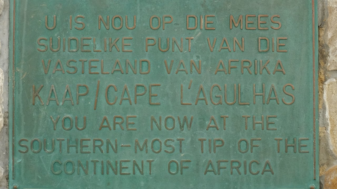 On the coast this is always more impressive than elsewhere, with high waves in the rough sea, gray sky that turns darker every minute and a lighthouse that fades into the mist. We drive a bit further south until we cannot go any further south and arrive at the Southern-most tip of the African Continent!! Where the Indian Ocean and the Atlantic Ocean meet in Cape Agulhas we have our picture taken at the monument to record this milestone.
Back in Struisbaai we pitch our tent at Cape Agulhas Backpackers, where we are warmly welcomed by Erin. In the colorful living room of the hostel she tells us all about the things we can do in the area. After she has put a locally brewed beer in our hands, she gives us the key to her bakkie to take her car to see the sun set at the wreck that lies just off the coast. We do not say ’no’ to that! Once we get there, the sun is already behind the dark clouds, but even the stormy sky over the stranded vessel made the ride to the coast more than worthwhile.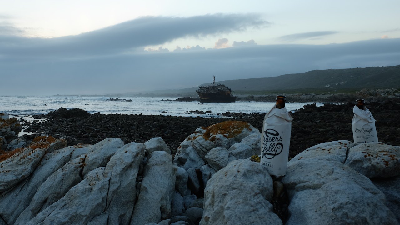
Back at the hostel we meet the Australian Nicholas. On arrival in South Africa he bought a second hand bakkie, which he transformed into a campervan with a mattress and curtains in the back. In the coming months, he will travel in his bakkie through Southern Africa until he sells the car again before he flies back home. We exchange tips and stories, drink a locally brewed beer and sing along with the swinging beats the local band is playing on guitar and harmonica.
The next day we drive from Struisbaai to Hermanus, this time following the directions Erin gave us. A beautiful route through Cape Agulhas National Park and the village of Elim, where a large number of houses of the first European emigrants has been preserved. Via Gansbaai and Stanford we arrive around lunchtime in Hermanus. The beautifully situated town is thè place for whale watching. The bay in Hermanus is directly from the shore very deep, which allows whales to come very close. 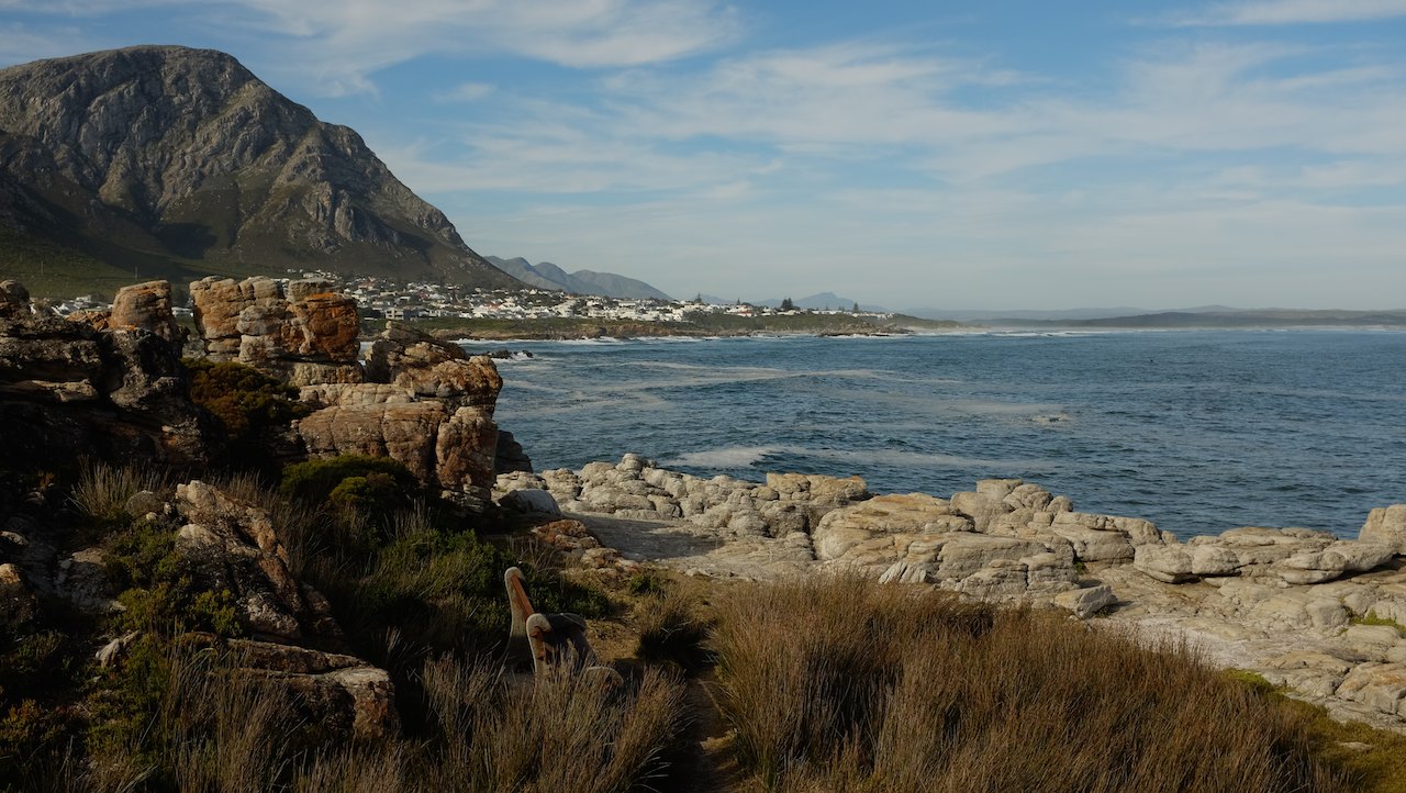 Sometimes they swim only five meters from the shore. The bay is used by the Southern right whales as a mating area. With a sandwich in one hand and binoculars in the other, we see one whale after the other. We thought we were spoiled in Mosselbay with three whales, but now we see at least 10 of them. They stick their head out of the water, flap their fins and lift their tails high out of the water. Now we are so close we can even hear the sound they make as they blow. Very impressive!
After a long lunch and a lot of whales, we drive from Hermanus to the R44 to follow the so-called Clarence Drive towards Cape Town. Apparently it is one of the most beautiful coastal roads in South Africa. We are still a bit skeptical about this title when we drive west through Betties Bay, but once we get to Rooiels, we both fall silent on seeing the stunning views. As far as we can see the road winds with great curves along the slopes.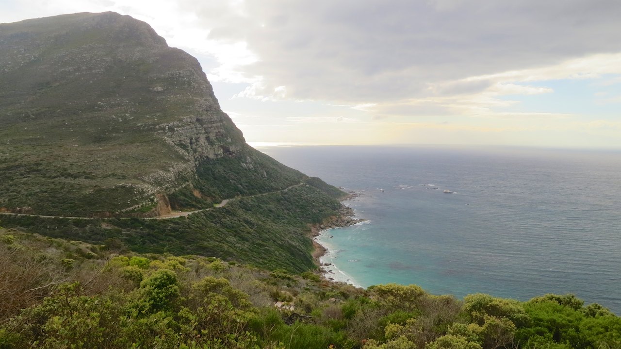 The sun begins to sink, which makes the views even better. The coast reminds us of the Amalfi coast in Italy we passed at the beginning of this journey and definitely deserves a spot on the list of most beautiful coastal roads in South Africa.
That night we sleep in a hostel in Simons Town. It will be our last stop before we settle in Stellenbosch to watch the campsite. But we are not there yet, because there is one place we want to go to before we park our bikes for a few weeks: Cape of Good Hope! From Simons Town we follow the beautiful coastal road along the eastern side of the Cape Peninsula.  While the air is getting darker by a surging storm, we drive through the park towards the southern most tip of the peninsula where we park our bikes right next to the monument. There we are, with the wind in our hair and a proud smile on our faces, right next to our loyal bikes at Cape of Good Hope. Awesome!
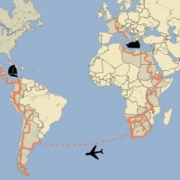
Distance to Cape of Good Hope: 26.056km (16,190 miles)
Previous story “‘Adventure’ in all shapes and sizes” – Next story “A house in Africa“
Nou Leonie en Peter, trots mogen jullie zeker zijn, op de route zoals jullie die hebben gereden tot aan dit punt en op de manier waarop jullie ons laten mee genieten. Supertrots op jullie!
Bedoel natuurlijk biltong maar heb auto correctie op mijn telefoon
Lekker he biltong, ik heb nog een stukje in de koelkast liggen. Een vriend van me neemt het zo af en toe mee uit Zuid Afrika.